Wednesday 30 November 2011

Travelling on east

The gorse was blooming for the second time along the river banks in Ullapool, and I've just realised we weren't plagued by midgies at all. Our second night in Waterside  House the wind kept the ferry in port and made walking out to find a meal unpleasant. We tried the Ceilidh Place but it was overun with young people, cables, sound systems and we dedeuced that a gig was taking place that night. I think we could have stayed, but it would have cost us £10 each on top of the bill for food and wine, and our eardrums are not accustomed to the atomic blasts of sound these groups generate. We found somewhere else!
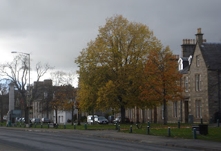
Main Square, Grantown

Next day we set off back to Inverness and had a splendid drive across the moors and down through the autumn woods to Garve, where the land changes slowly into lowland scenery. Green, fertile and gentle after the north west.  Climbing the hill out of Inverness heading south on the A9, we turned off onto the A938 and headed for Grantown on Spey, where we stopped, had a coffee and walked through the town and across the wetlands to the river Spey. Halfway around the town, our mobile phone rang and the family wished me happy birthday from Australia!  Many years ago I'd been here, and remembered huge pine forests running down to the river, which tumbled over rocks at a huge rate of knots. The river we saw was a disappointment, and there were no pine trees. Instead we had to detour under a new by-pass that has been put in, and the river was flat, brown and uninspiring. Disappointment all around. They say you should never go back, don't they? So we headed out on the  939 through Lynemore and Bridge of Brown to Tomintoul. Pretty countryside, and so very different to the north west!

Monday 28 November 2011

Sun and wind

Ullapool Bridge
Heading into town today to do some necessary shopping - not for Christmas, I  might add, but for soap dishes and toilet roll holders - really exciting stuff! I'm hoping we've done all the DIY-ery we're doing for a while at least, and then I might be able to relax into writing a little bit more instead of listening for the terrible crash of falling tiles, or worse, of falling bodies.
Glastullich
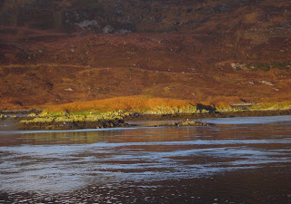
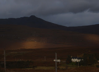
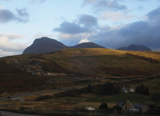
So, after a brisk explore of Ardvreck, we  drove on down the A835 towards Ullapool and telephone the Waterside Inn to secure a bed for the night. Once settled in, we walked out in sunshine along the shoreline and the river towards Ullapool Bridge and then on up the track towards Loch Achall. A pleasant walk  uphill, now and then standing aside for the huge lorries working the quarry, which has expanded a good deal since we were last on this path. Eventually the track crosses the river, where the views open out, with Glastullich peeping out across the hillside and the loch disappears ito the distance. Much better weather here than a few miles further north! We walked until we got tired and then turned back, looking forward to a good meal and a good night's sleep. We'd just got back into our room when the five o' clock ferry hove into view. It reversed in, and, as it happened, stayed there. The wind was rising, and forming little waves on the loch, so out on the Minch it must have been quite rough. Everyone hoping to get across to Stornoway that night was stuck.

Friday 25 November 2011

Ardvreck

Working hard on Matho's story now. It's been put aside for the right amount of time, and I can see why the three agents I submitted to said they liked the story, the premise, the setting but were not sure they liked the writing - though they thought that was confidant and well done. The comment certainly me puzzled and I decided to withhold sending it out any more until I'd gone through it again.  Reading historical stuff on the market today, and then reading my ms, I see that I have been influenced by US writing standards - short, clear sentences, short paragraphs and little description. Seems that is not what UK agents are accepting, but at least I know what to do now.


Ardvreck Castle
Back in the north west of Scotland, we tootled up and down the front street of Lochinver, and stared out at a grey horizon were sea and sky simply merged into one another. Clouds sat on the mountains, and everything looked grey. Few shops, mostly closed because now it's out of season and few people about. Not an entrancing prospect. We've visited the Highland Stoneware Pottery many times, and didn't want to do it again as it just makes us want to spend more hard-earned cash. Getting out and walking some of the very pretty walks we've done before - one to Achmelvich, another to the Kirkaig waterfall, would be an invitation to another drenching.

So we set off east out of Lochinver on the A837 alongside Loch Assynt and Ardvreck Castle on the way back to Ullapool. I photographed the notice board, which hopefully will show up more clearly if you click to enlarge the pic, because there is little left of the castle. It stands on the island side of a neck of land jutting out into the loch, and a cetain times of the year when the burns are in spate and feeding the loch, it's possible they'd be splodging to get across.
Ardvreck

It's a pity it's so much an unstable ruin, because it was built around 1490 and in use in the sixteenth century, which is the era that really interests me. I came away with an impression of huge grey stones and wobbly bits of wall, small rooms and a wet and windy place to live - even today.

Wednesday 23 November 2011

A dour, grey day

I read a blog this week that still has me thinking about what it is that I might be doing incorrectly with my latest story. If you want to give yourself  a session in frustration -
here is the place. If I hint at headings such as Limp and Lifeless Prose, All Questions but No Answers, I think some of you will get the drift of the piece. if you don't write, but read a novel a week, you might still be interested.

Clashnessie
Stoer
As for my travels in the north west, let me begin with the moment we stopped to admire the beach. We thought we were looking west at the Atlantic, assumed it was Stoer or even Clachtoll, but just a minute, isn't the sun in the wrong place? Hauled out the compass - yes, I do carry one, just in case of need! and then the map, and discovered we were staring due north at the rollers coming in across the sand of Clashnessie Bay. So, we were not as far on as we thought. Still, the driver needed a break from dipping and diving around blind corners, so we sat for a while. I think there were a total of a dozen houses that made up the village of Clashnessie, and some of them were a mile apart from their neighbours. As well as the typical modernised croft-cottage, we noticed large two and three story new builds away on the hill behind the village. Perhaps in season they take in tourists, but the end of October seems to be the signal for the end of the season. Certainly we had the road to ourselves. I think we passed only three or four cars, and they were all going in the opposite direction to us. A message there, perhaps!Once we moved out of the village, we caught a glimpse of a massive waterfall in the distance. Better weather and we might have walked over to it.

It was certainly spectacular, and I suspect it was so because of the overnight rain backed up in Loch an Easain and its chain of interconnecting lochs in the hills behind Clasnessie


Clachtoll
Moving on south and then south west toward Lochinver, we passed several settlements - Stoer with the graveyard and the roofless church, Clachtoll with the beach and a campsite - though we didn't see a single tent marring the bright green grass - and through the bleak, rocky moorlands.  Away in the dsitance we caught a glimpse of aWe passed the turning for Achmelvich, off to our right, and had the weather been fine we would have gone to the  wonderful white sand beach. But in dull grey misty weather even stunning beaches look damp and miserable. We pressed on to the T-junction and were so glad to be on a dual carriageway once more.

Monday 21 November 2011

Heading west


The B869
Well, our first real walk ending in getting soaked, and the next morning the weather didn’t look any more promising. Odd, really. I’ve had several holidays in this part of the world at this time of the year and there’s always been a week of sunshine and blue skies. Frost at night, perhaps, but who cares if the day is fine? This year is obviously not going the same way. So we decided to move on and headed off towards Lochinver. Back down the A894 a little way and then off west on the narrow, twisty B869.


Looking north
Wonderful views in spite of the dour weather. And because of the rain (it kept it up all night) the waterfalls were in full spate. Once we got to the top of the hill, so to speak, we could look out across the north of Scotland, and as always, it looked sunny everywhere but where we were. One of the unwritten rules of Scotland is that if the weather is bad, then move on; it will very likely be sunny in the next valley.
We proceeded cautiously. There’s little else you can do when the road is only wide enough for one car, and if you meet something coming in the opposite direction, there’s a scramble to find a place wide enough for both to pass safely.  We found a village at Nedd, quite a sizable community for the remoteness of the spot. I found myself wondering if Tesco delivered from Ullapool, or if the inhabitants drive the fifteen miles to Lochinver every week for groceries.  I suppose I drive ten miles to my favourite supermarket once a week, but that’s on easy dual carriageways, not up and down hillsides on single track roads. Where does everyone work? Perhaps they all work at home via the internet super highway. It’s possible. The outer edges of Scotland were into the electronic age long before everyone else, though it must have been frustrating wback int he days when using the internet tied up your phone line. 

Friday 18 November 2011

A drenching

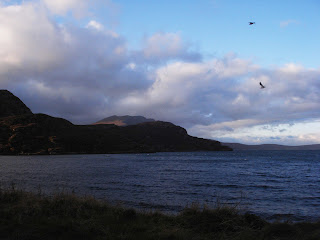
We walked along the shore to the old ferry landing on the north side and then on along the shore of Loch Glendhu. There's a pretty section through the forest and then out along the open shore line, which offered dramatic views of the hotel, the bridge and the mountains rearing up behind. If you look closely, you can probably see where we walked; we passed the first waterfall coming down the hillside, and the next was just around the corner, where the  shadows start - it was also the exposed corner where the storm caught us, at the furthest extreme of the walk and with no shelter anywhere.

sunlight across Loch Glendhu (from the hotel window)

the sparrows were wet, too

By the time we got back to the hotel we were drenched and a hot bath was the only sensible thing. The sparrows came huddling in by the hotel during the worst of the rain while we sat in the lounge with a log fire and the beautiful view of the loch as the weather drifted over, the sun came out and the tide came in.
The land in the picture forms part of the Reay Forest which belongs to the Duke of Westminster and there's more information here, plus a rather nice video of the area. Taken in better weather than we had, I must say.

Thursday 17 November 2011

Kylesku

Low tide at Kylesku
Tuesday I visited Chatsworth House with friends, and yesterday spent the day shopping and taking in a production of Nutcracker in the evening, which is why there was no blog post yesterday. Obviously I'm having far too much fun - but it was long overdue!

More of Chatsworth later - first I want to finish my Scottish trip. Pity about missing the Bone Caves, but we just pressed on  into Kylesku where the Hotel is set in an enchanting spot right by the lochside.  The Atlantic roars inland from Eddrachillis Bay and forms the  Loch a Chairn Bhain, passes beneath the new bridge, built at the narrowest point, hence the name. Seton Gordon writes that Kylesku is a bad translation from the Gaelic Caolas Cumhang meaning the narrow strait. (He also claims that Quinag in Gaelic is Cuinneag and means milk stoup.) Once under the bridge, the loch divides into two - Loch Glencoul runs south east and Loch Glendhu runs east.
Looking across the water to the ferry landing at Kylesku
The bridge  was built in 1984. Before that, the cattle had to swim across to get to market and the drovers and travellers used a rowing boat. If you check the link -
 http://www.undiscoveredscotland.co.uk/kylesku/kylesku/index.html. you will see pics of the bridge in far brighter weather than we had. I can remember using the old ferry, the Maid of Glencoul way back in the seventies. Her predecessor, the small, forlorn Maid of Kylesku is slowly rusting away where she was beached on the northern shore, not far from the picture above.

Monday 14 November 2011

Map reading errors

Reay forest
On 5th November a review for Fair Border Bride appeared on Historical Novel Review, which is very attractive review site you might well want to bookmark if you don't already have it in your favourites.

As well as reliving my trip to Scotland, I'm plodding on with work. Why is it that a synopsis always looks fine until I print it out, which is when I discover that it has mistakes and doesn't read too well? At this rate I'll never have a synopsis that will entice anyone to buy!

The last time I drove the A835, it was pouring down when we left Ullapool and still raining when we reached the Bone Caves at Inchnadamph. The rain was so heavy we didn't dare to get out of the car and attempt the walk up to the caves, but sat inside and watched water pouring down the mountainside in various spectacular waterfalls. So this year our goal was to enjoy the walk up the valley Fuaran Allt nan Uamh before we went on to Kylesku. The weather was OK, it was only four or five kilometres and we had the right map, boots, waterproof coats. (Often a failing of ours is not having the correct map for the walk we wish to take!)

Kyleskyu Hotel
So, we proceeded north, admiring the sight of Loch Veyatie and Suilven beyond, and guessing which mountain was Canisp and which Quinag. Before we knew it, we drove through Inchnadamph, a tiny place with hardly more than six dwellings and a hotel, and doubt set in. As we drove past the confusing peaks of Quinag,we realised we were almost at Kylesku and somehow, we'd driven right past the turning for the Bone Caves.

Friday 11 November 2011

The weather makes for interesting pictures. As I said in previous posts, we left Ullapool by 9 in the morning and drove out on the A835 and made only one or two brief stops to take in the view (believe me there are not many places where you can stop!) and yet, looking at the photos, one could be forgiven for thinking they'd been taken hours apart.
Not so. Today's batch are all taken in the stretch with Cul Beg and Cul Mor on the left and the vast cliff face of the Cromalt Hills on our right. Click to enlarge the picture and you may see the deer, but I doubt it!

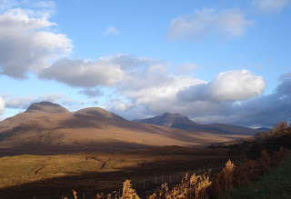
The other thing about mountains is that they change shape. Not so much when walking, perhaps, but drive a few miles by car, look back and it's sometimes a struggle to recognise a single peak. Suilven is famous as a rounded hump on the eastern horizon when staring out from Lochinver. From this road, looking west, it presents a conical ridge and when we get further north, I'll be looking out for it.
At various places along the 835 it's possible to catch a glimpse of the old road winding off around an outcrop of rocks. Not wide enough to take one of today's cars, possibly wide enough for two people walking abreast, or more like a man walking beside his pack pony. It's a forlorn reminder of days gone by, and a shiver runs through me as I think of walking alone here a hundred years ago without a telephone, a car or any real map. I discovered the other day that travellers maps used to run in strips; a single road with way markers. No doubt you could roll it ip and put it in your pocket! Or maybe not. Flat packed in oiled canvas might be safer.
There's also admiration for the men who brave all weathers here to take electricity and telephone wires to isolated communities. Every now and then telegraph poles stalk across the tracts of swampy land and march straight up into the mountains, sometimes up the cliff face on our right. I wonder at the creatures who live up here, exposed to wind and rain even in summer, and icy blasts and snow in winter.


Stopping briefly, we look back the way we've come. From here to Ullapool isn't that far, as miles go; but in other ways, it's a whole different world.

Wednesday 9 November 2011

On the A835

Strathcanaird
The A835 is a splendid road as it winds and curves through the mountains of Coigach towards Assynt. Strathcanaird is the last habitation for a while, and this is not a road for those who like Little Chefs, craft shops and cafes dotted along the way. It's a road that is a feast for the eyes, and pity the driver who dare not look at the scenery for fear of driving off it!


Stac Pollaidh
Mountains have a character all their own, and I often get the feeling that its not me that's moving, but them. They're not high, as mountains go; few of them are Munroes, over 3,000 feet. But they stand isolated and humped and jagged in the landscape and look as mountains ought to look. Take Stac Pollaidh for instance. Not quite 2,000 feet, if memory serves, but it stands above Loch Lugainn like a cone with a ruffled top. From the summit you can look out, as I once did, over a vista of lochs and bays and out to the sea shining silver in the sun which isn't that far away in this picture. Imagine it, out beyond Stac Pollaidh.
If we'd driven just a hundred yards further, the road would have climbed that little bit more and the picture would have included the loch. 
Cul beg and Cul Mor
It is a road full of surprises. There are footpaths, in the sense of hill tracks, in case I give the wrong impression, that lead to the mountains. Many of the small laybys have a parked car or two and no occupant enjoying the view or sipping thoughtfully from a thermos flask of coffee; they're often to be spotted plodding their way up some impossible seeming hill a couple of miles away. There are deer to look out for, and on this occasion, we found a herd of perhaps thirty, with a magnificent stag  in charge. We watched them with binoculars for a while, but they were too far away for photographs. On my little camera, they'd have been no more than shades of brown among the brown heather.

An aside: as I learned my units of measurement in the good old English way of inches, feet, yards and miles I cannot cope with the metric system. I know a metre equals 39 inches, so if I have to, I grab a calculator, tap in the number of metres, multiply it by 39 to get inches and then divide it by twelve to get feet. Then I can understand, because feet mean something to me.

Monday 7 November 2011

Ullapool north

Waterside House does an excellent breakfast with raspberries, blackberries and blueberries to add to cereal. Dh dickered over kippers, but decided against it in favour of a full Scottish breakfast, including haggis and black pudding. I opted for the more cholesterol free choice of poached eggs on toast.
Thus fueled for the day we packed and set out, eading north to our next overnight stay at Kylesku Hotel.  There's a long uphill drive out of Ullapool, down and then up again through a pass to Ardmair where a clutch of holiday cottages sit on the beach staring out over Loch Kenaird. Behind them are the green fields running back up to the crofts tucked in against the mountains  - Cnoc Moin a Ghuail at 240 metres. 780 feet doesn't sound much, but the land goes from sea level to 780 feet in a little over a kilometre, or less than a mile.
Ardmair
We parked on the beach and watched the Cal-Mac ferry come steaming up the loch and disappear behind the headland Meall Mor on its way to Ullapool. The ferries always look so good, especially in sunshine when their colours stand out against the water and the hills.
Strath Canaird
Driving on took us alongside the stream they call Glutton on the map. Maybe there's an interesting translation - if I find out I'll let you know. Emerging at the top of that hill, there's a long curving run down to Strath Canaird and across the River Canaird at the lowest point. Here there's a turn-off marked Blughasary wich leads to a small clutch of buildings and a car park. Once upon a time the postie used to take the path from Blughasary and walk the cliff path to Achiltiebuie with letters. I tried it once, in my younger and fitter days, and found it was like walking on a cliff face. The path is marked on the 200 metres contour, with a sheer drop to the sea. It's for those of strong nerve.

Friday 4 November 2011

First review and Scotland

Lindsay Townsend gave me 5 Stars!
here's her review of FAIR BORDER BRIDE

"A beautiful bride in a turbulent country....
From its fast-paced, compelling opening, 'Fair Border Bride' is an exciting historical romance set in the border lands of northern England in 1543. The romance of Alina and Harry is full of incident and tenderness and is a well-told story, with moments of humor, sensitivity and passion. They are sympathetic, rounded people and believable in their dilemmas and conflicts. The other characters in the novel are also very well-drawn, and the whole is filled with fascinating historical detail about a part of England that is rarely explored in Tudor historical fiction. If you want to lose yourself in vivid adventure and romance, I have no hesitation in recommending this novel by Jen Black."

  ******************************************************************

We arrived in Ullapool around 4pm. The journey took 7 hours, door to door. Not bad. I'm aware it probably  doesn't sound much to those who live in larger countries, but France, Canada and the US have so much open space to build wide roads, whereas we're just a tiny bit cramped.
 Ullapool looked as gorgeous as ever as we drove down Loch Broom and saw the buildings, shining white in the sun, sticking out into the middle of the water and with the hills rising behind. We’d booked at Waterside House on West Shore Street and stared straight down from our first floor window into Loch Broom.
They say Saint Maelrubha came here from Ireland around 722. Certainly the Vikings were at Ullapool. Their galleys rode at anchor in the fine anchorage of Tanera Mor, and by 1775 there were approximately twenty buildings and a road where West Argyle Street and West Terrace now stand. In 1698 a fishing station was set up at Ullapool with the intention of developing the export of salt herring from Wester Ross to Stockholm, London and France. Herring were so abundant in Lochbroom that the people were using them for manure but it was not until the growth of Glasgow as a port, and as a exporter of salt and dried fish across the Atlantic for the slave trade, that the commercial fishing of the remote north west coast became feasible. If you want more history click
We walked about, enjoying the crisp, bright sunshine. There are two good bookshops in Ullapool, and at least two shops selling expensive knitted fashion garments, three fish and chip places cafes, and numerous pubs offering meals. We settled on the Ceilidh Place, which always seems to have young staff from other parts of the world working there. We chose venison stew in red wine, and found it delicious. click

Wednesday 2 November 2011

First day continued

Ben Wyvis
The run through Carrbridge, Tomatin and down to Inverness was marred by road works which always make me grind my teeth in frustration. Except for brief stretches of dual carriageway, where the speed limit is 70mph, most of the journey is single carriageway and limited to 60 mph. Road works frequently reduced this to 40, and sometimes 30 mph.

The worst bit was where a convoy system was in operation, with long tails of traffic following a ditzy little vehicle at a very sedate 30mph. Still, once we've crested the last hill, the view down to the Moray Firth opens up and it is so spectacular it always makes up for any delays. I didn’t take pictures because I was driving, and anyway we were dithering about stopping for petrol. As it happened, we didn't and I continued on across the spectacular bridge where the Moray Firth becomes the Beauly Firth, and took the A835 to Maryburgh and on through the soft green fields to the wooded hillsides of Garve.
 
Somewhere here we changed drivers again, and it’s at this point that the land starts to rise through the forests and the bulk of Ben Wyvis looms ahead and then falls behind us. The railway line follows the road at this point, but it soon branches off down the Strath Ban to Achnasheen and on to Kyle of Lochalsh while we take the right fork towards Ullapool. For a while the land is bleak and barren, though at this time of year the land is covered with the rich golden brown of bracken and heather. The contrast of such colour against the blue sky is wonderful.
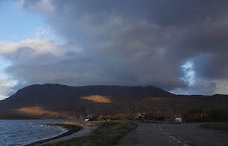
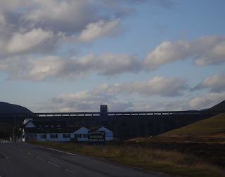
Aultguish Inn
It isn’t long before one of the less spectacular sights of Scotland looms into view – the dam at the end of Loch Glascarnoch, immediately behind the Aultguish Inn. I doubt I’d sleep very deeply if I ever stayed there, for I'd be imagining the dam wall breaching and water pouring out onto the inn. Happily it isn’t an establishment we’d ever choose to stay unless caught in a snowstorm, for it seems to be the haunt of bikers, backpackers and those who like loud music in their bars. Scotland isn’t all spectacular. Particularly on the west coast, machinery is often abandoned and left to rust into the ground. Modern homes are plonked down in the middle of wonderful landscapes, and the old home, no more than three tumbled walls of grey stone and a tall chimney gable, rears up like a lone tooth, sometimes only yards away.


Ahead the mountains are rising. Excitement rises with them.

Tuesday 1 November 2011

First day

Byrness
Wednesday 26th we set off around nine in the morning and about fifty minutes later cruised over Carter Bar and into Scotland. It was one of those autumn mornings where you’re never sure if the weather will get better or worse, but you keep hoping for the best. From the Tyne valley, Northumberland is open country with Otterburn the only village of any size.

  The A68 was empty. In places, mist rose along the streams and rose up from the trees like smoke against the blue and grey sky.
 Once we wound our way up, over and down Carter Bar  we hit the dreaded speed cameras. There must be 18-20 between the border and Edinburgh, and I’m sure they’re there simply to catch all the English who venture north.
We made it to Edinburgh inside two hours, but in summer, when the tourist traffic is high volume, then the single carriageway and all those speed cameras can turn the journey into a three hour marathon.

Blair Atholl woods
 We headed north across the Forth Road Bridge, no longer a toll bridge thanks to Alex Salmond, and hoped the rusting cables inside the structure – the ones that hold the bridge up - didn’t snap while we were on it. We changed drivers at Kinross, about level with Loch Leven, and I drove on up the A9 around Perth and on up to Pitlochry. Around Blair Atholl Castle I turned off onto a side road, found a layby among the trees and we had a sandwich and a cup of coffee.

I tried to get a picture of the castle but found I risked life and limb back-tracking on foot down the road to find a clear spot in the trees. Discretion clicked in. The picture wasn’t worth being squashed between a stone wall and a 4X4 racing by at 60mph.

If you want, you can track the journey on Google Earth. Start from Corbridge and take the A68 north through West Woodburn and join the A696 just north of Otterburn. On up through Rochester and Byrness to Carter Bar, then down past Jedburgh, St Boswell’s, Lauder on to the Edinburgh by-pass, going around the west side of the city. If you wwnt to see the pics in more detail, click on them. They should enlarge on a new screen.

To my shame...

The Best Books of 2023: Historical Fiction (according to Waterstones.) The Fraud by Zadie Smith Taking inspiration from a real-life ninetee...